
In the third semester of my postgraduate studies, I walked down the untrodden path of ‘Cultural Landscape’; a concept that was new for me. Cultural Landscape is described by the World Heritage Centre as ‘a diversity of manifestations of the interaction between humankind and its natural environment’. As a class, we were learning about the concept of Cultural Landscape from different perspectives in the form of numerous subjects that we had. In every semester, these exercises took us to a different region of India where we understood the practical application of all the theories learnt in class. The third semester became extremely special as we got the chance to visit one of the most famous hill stations of India…..Shillong. Brimming with excitement we embarked on a 30 hours long train journey from Delhi to Guwahati where we took cabs to reach our final destination. After three hours of admiring the beautiful landscape and stopping at the viewpoint of Umiam Lake for a quick photo shoot session, we finally arrived in Shillong.
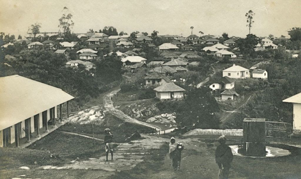
Image Credits – https://mrbiped.wordpress.com/2010/10/24/shillong-then-and-now/
The city is located on a plateau known as Shillong Plateau and it lies in between the Khasi and Jaintia Hills. The plateau is bound by Umiam Lake on the north and the hills of the Assam Valley to its northeast. From a historical perspective, only a few records are available of the Shillong Plateau before the colonial annexation and most of them mentions the plateau in relation to the Surma – Kushiyara Valley and Sylhet. Before the arrival of British forces the region was mostly ruled by Khasi and Garo chieftains who were the original inhabitants of the land. In 1858, Khasi and Jaintia Hills were annexed by the colonisers and its district headquarter was established at Cherrapunji. However, due to the constant rain and inadequate means of transport and communication, a decision was taken to shift the headquarters. The task of finding a new location was given to F.A. Rowlatt, a land surveyor who proposed the site of Shillong Plateau among other locations. During this time, there was a small village on the plateau known as Yeodo. In 1864, the colonial administration decided to build a metaled road between Guwahati and Sylhet and Rowlatt mapped out a convenient route that passed through Yeodo.
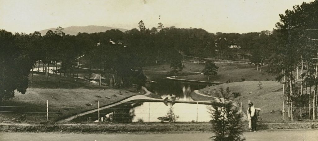
Image Credits – https://mrbiped.wordpress.com/2010/10/24/shillong-then-and-now/
The landscape of Yeodo reminded the colonisers of the rolling hills of Britain and appealed them instantly. District headquarters of Khasi and Jaintia Hills was shifted to Yeodo and it was renamed as Shillong in 1866 by Colonel Henry Hopkinson after the Shillong Peak.
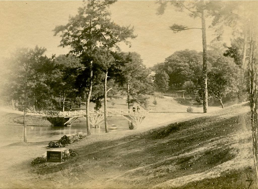
Image Credits – https://mrbiped.wordpress.com/2010/10/24/shillong-then-and-now/
Shillong welcomed us with a heavy rainfall which continued on for 2-3 days. The continuous shower had conjured up a mystical atmosphere which when coupled with the serene landscape had a spellbinding effect on all of us. Although we ended up traversing most parts of the city, our study was limited to the area established by the British. Like other hill stations, Shillong also has the characteristic feature of the hill stations which includes Mall Road, spacious estates with large bungalow, and tree lined avenues.
One of the other discerning features of Shillong is the elaborate riverine system which is the resultant of its location in the Khasi and Jaintia Hills and the climate. Two major rivers of the city are Wah Umkhrah and Wah Umshyrpi (Wah means River in Khasi) which formed the boundaries of the British settlement. There are various perennial and seasonal streams that drain into these rivers and also result in the several waterfalls located near the city namely Crinoline Falls, Bishop Falls, and Beadon Falls. The water system of Shillong will not be complete without mentioning the Ward’s Lake which is presently located near the Governor’s Residence.
Originally a spring, it was developed as a storage/tank for drinking water by Colonel Hopkinson and was named as Hopkinson’s Tank. In 1893 the area was further developed by Sir William Ward, the Chief Commissioner of Assam, by constructing a small dam on its north-eastern side to collect water from several streams into a large water-body which came to be known as Ward’s Lake. In the great earthquake of 1897, most of the lake was destroyed when the stored water gushed out. In the reconstruction years of Shillong, Ward’s Lake was developed again with a garden adjoining it.
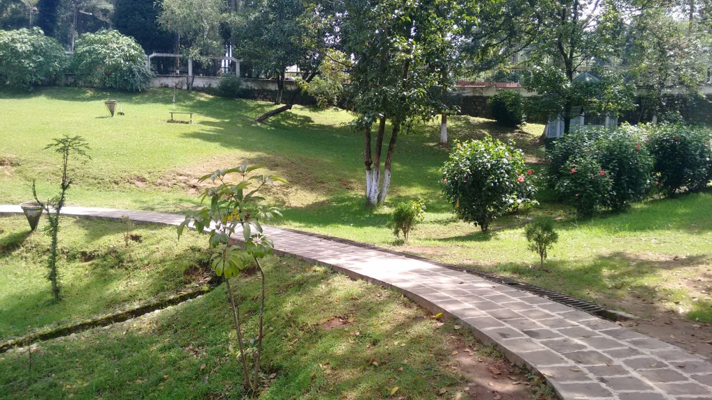
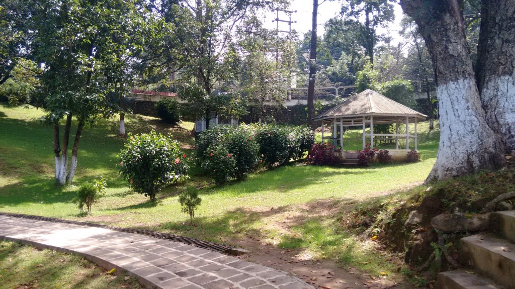
Most of the British settlement was constructed along the catchment area of Ward’s Lake because the garden of the lake was designed as a typical English garden with walks, a bridge across the lake and seasonal blooms amid tall pine trees. The road surrounding this garden was the promenade (also known as Mall Road) for Europeans in Shillong. Most of the larger estates faced this lake and the Mall Road.
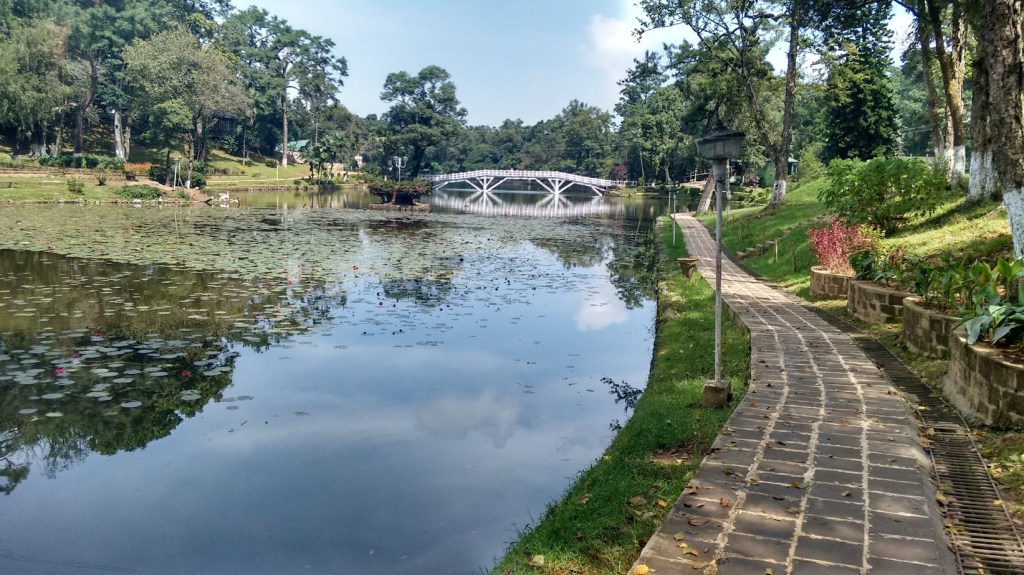
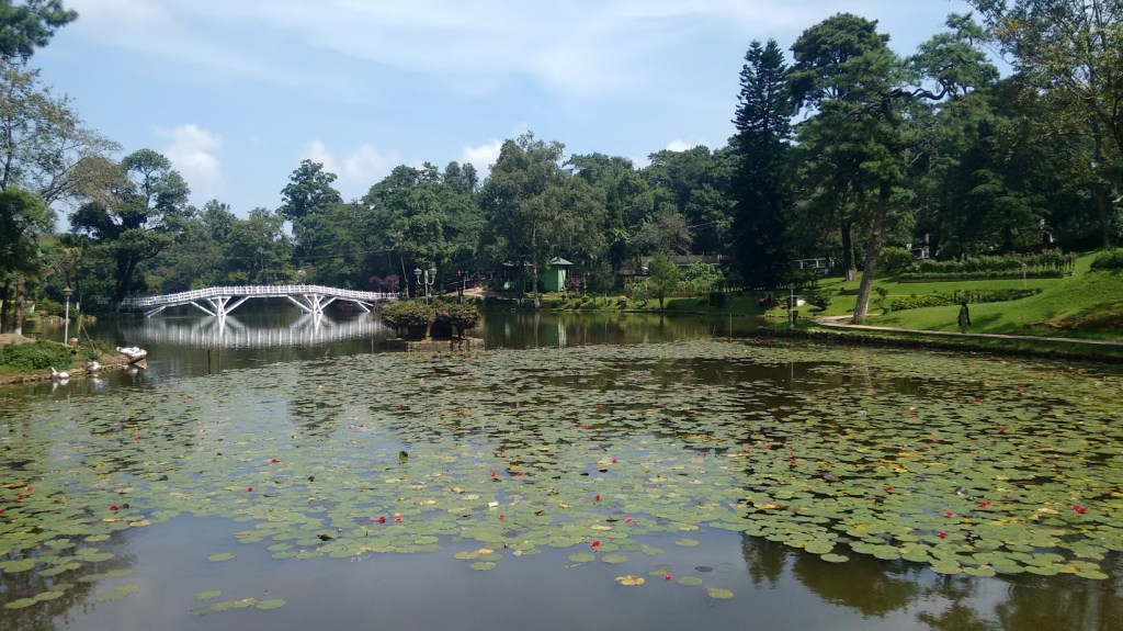
Presently, it is located about a kilometer away from Police Bazar Point, the busiest commercial centre of the city. Historically, the lake had a direct visual connection with the main roads, known today as Camels Back Road and Soso Tham Road. Now that connection has been lost due to the construction of enclosure wall. Although this lost connection has its disadvantages, it has a major advantage too. After entering the premises one loses the sense of the outer world and is enchanted by the old world charm of the place as the visitors experience a hint of the European landscape. The grassy slopes, flower garden, lofty trees, and the wooden bridge across the lake attracts not just the locals but tourist as well. During monsoon, the place becomes a sight to behold.
I spent a lot of time near the lake and its adjoining areas as I was researching on the streams that fed into the catchment area of the lake and has been lost over the years. In the last few decades due to increase in tourist influx and construction activities, the character defining features of the city are now in danger. Most of the streams have disappeared or have been reduced to the status of nalla, rivers are being encroached upon, and Ward’s Lake is struggling to keep up with the increased tourist inflow.
Here, I also want to clarify that I chose to write about cultural and natural landscape in this post in order to clarify the most common misconception that only built structures qualify as heritage components. Natural landscape and its interaction with humankind is something that we have inherited from our ancestors and they are as much a part of heritage as the built components.
So, at a time when the world is facing water scarcity more than usual, reviving these water systems in their natural landscape is our only hope of battling the huge challenge that humankind is facing today.
Sources:
- Hussain, Imdad. From Residency to Raj Bhavan: A History of the Shillong Government House. New Delhi: Regency Publications, 2005.
- Kennedy, Dane. The Magic Mountains: Hill Stations and the British Raj. Berkeley: University of California Press, 1996.
- Ray, B Datta. “History of Shillong”. The Shillong Times. URL: https://theshillongtimes.com/2019/08/10/history-of-shillong/
- Sawian, Samuel. “Shillong: Then and Now, An Earthquake Story”. The Adventures of Mr. Biped. URL: https://mrbiped.wordpress.com/2010/10/24/shillong-then-and-now/
- “The Complete History of Shillong – a Chronology (1303 – 1974)”. YellowBaobab.blogspot.com. URL: http://yellowbaobab.blogspot.com/2016/09/the-complete-history-of-shillong.html
A detailed article on Shillong was published on the platform of ‘The Dwima Collective’. The article was co-authored by the author and can be read at:
